www.BadgerTrek.comAbout/ContactWeb LogOur Camper Van
Resources:Hobbies:MotorcyclesAmy's CakesOutboard Hydroplane RacingRadio Controlled Toys |
Lippencott Mine Camp
We spent a couple of days camped out at our little perch off of the Lippencott Mine Road. It proved to be an ideal spot for getting a little “real work done”, as well as a good base camp location. I even found a nice flat spot, up the hill a ways from the van that was perfect for yoga! That first evening we hiked up some of the surrounding hills to get a better look around.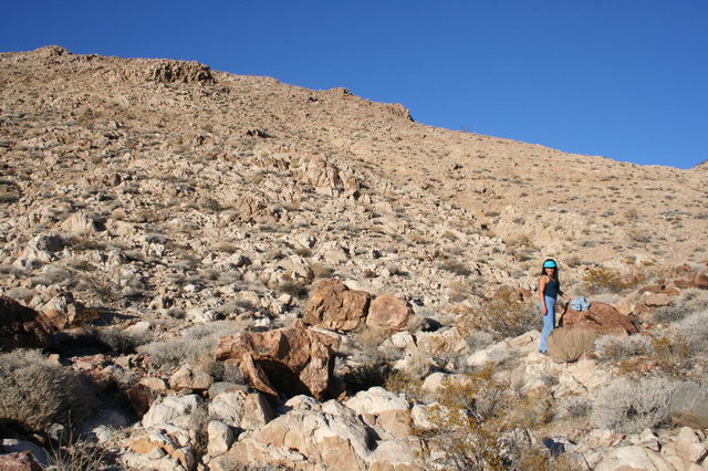
Bicycling over to the Race track and climbing the Grandstand
A few days later, we made a bicycle trip over to see the “Race Track” a sandy oval playa that was home to the mysterious “Sailing Rocks”. There were rocks of various sizes, some up to several hundreds of pounds, which were said to move across the desert playa, pretty much of their own accord. And their tell-tale tracks that they leave in the sand still have scientists speculating. 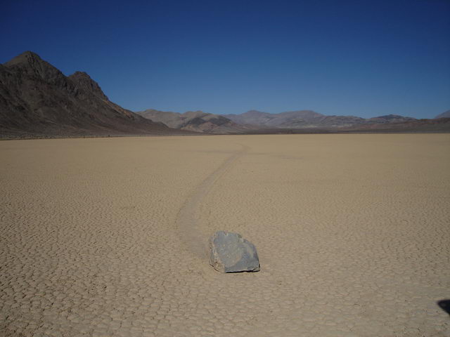
After we examined and interrogated various “sailors” and concluded that with no amount of cajoling or threats could we wheedle their secret from them, so instead we peddled over to the “Grandstand”. Since the rocks race around a “Race Track”, it would only come to reason that a big friendly lump of rock rising up from the Northern end of the “Race Track” would be named the “Grand Stand”. Funny enough as it was, it kind of looked like what I would have imagined a naturally formed grandstand would have looked like (if God were at all like Dr. Seuss). It was tall, providing great views and perches 360 degrees around and with easy climbs up. So naturally, we climbed up to the top for lunch!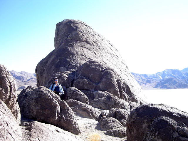
Teapot Junction
After several nights camped at the Lippencott mine road, we decided that it was indeed time to move on. Part way out of the Race Track Valley we stopped at Teapot Junction to admire the sign and its many adornments. 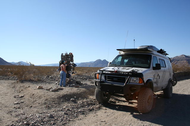
A short while later on we met a fellow Sportsmobiler, Wynn, who was headed in the opposite direction. We stopped to exchange pleasantries and chatted about our mutual interests.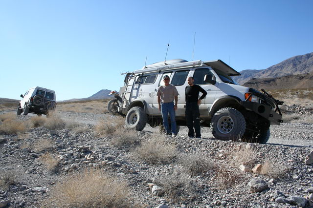
Ubehebe Crater & the Motorcycle Rally
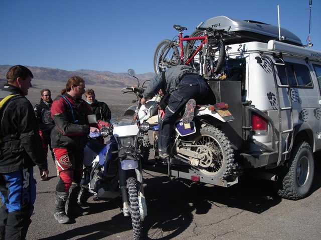
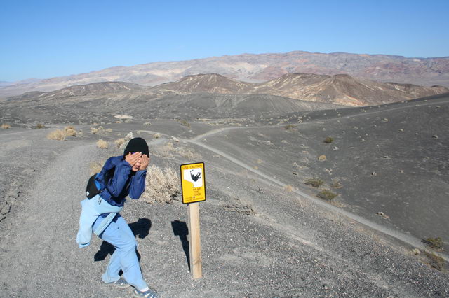
Midmorning, we stopped at the Ubehebe Crater, a great gaping maw rising up out of the ground, for a hike and some lunch. A short while after we pulled in, a friendly motorcyclist came over and chatted with us for a while. Apparently he and his group were there as part of the ADVRider.com (Motorcycle) Rally weekend (DV Days). One of his buddies was running low on gas, and probably wouldn’t be able to make it to their next gas stop. So naturally, we helped out our fellow bikers and sent them on their way with a couple of gallons.
| Afterwards, we hiked around the main Ubehebe Crater, enjoying each others company, the amusing signs warning of terrible peril, and taking in great views all the way around. | 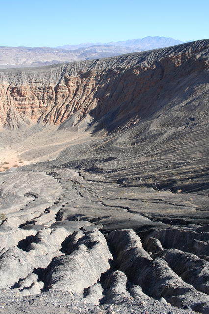 |
Cottonwood Canyon Camp
In the afternoon, we found an easy trail that started near Stovepipe Wells. It was a little more populated and we followed it out to Cottonwood Canyon to go exploring and hunt for petroglyphs.
We had one tranquil night, with our camp to ourselves in the wash of the Canyon.
The Creepy Bum Camper Neighbor
One of the hazards of camping in more populated areas is that one occasionally runs across a busy-body neighbor. Up until that next morning, we hadn’t really had any issues with people coming up and yelling hello when all of our window shades were drawn up and the door is obviously closed. However (lucky us!), our luck changed this time and we were blessed to get an annoying neighbor who decided that, stranger that he was, he would park just a couple hundred feet from our camp spot.
He seemed really desperate for company, wouldn’t shut up, and had a really annoying barking-whine of a laugh that grated on my ears. Anyways, didn’t like the guy, his dress and rig were pretty shabby looking, and he was cooking something awful smelling in the back of his truck. And I liked it less when he came over later in the day to look around at the van. No way was he coming in.
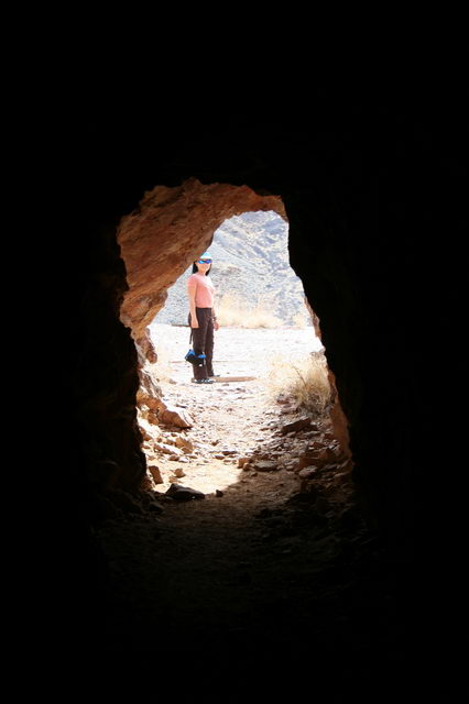
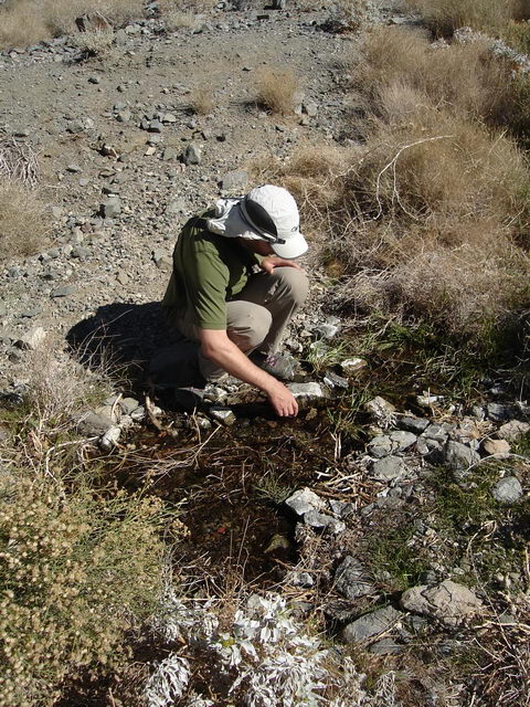
Marble Canyon – the Failed Quest and the Really Cool Side Trip for Rock Hounds
Later that afternoon, Erik and I went on our penultimate quest for Petroglyphs. We hike a short distance from the wash where we were parked over to the next Canyon called Marble Canyon. I think it was named so for the marbling of the rocks along its sheer faces. On the way over to the canyon, we walked over a raised area, between washes and saw some pretty cool looking rocks – the kind that appealed to the my “rock-hound” sensibilities. And I marked the spot on my GPS so that I could return to pick up a choice rock or two on the way back to camp.
We walked the length of the Canyon, blinking in the sunlight and peering around, trying to spot our quarry, in the glare of the sharply contrasting light and shadows. But alas, they proved to be too elusive for us. We even resorted to climbing a few ledges, but the description in our guide book was but a sentence and there were so many surfaces to scan that in the end, our efforts proved fruitless. We did observe however, that the rocks that formed the canyon were very, very sharp.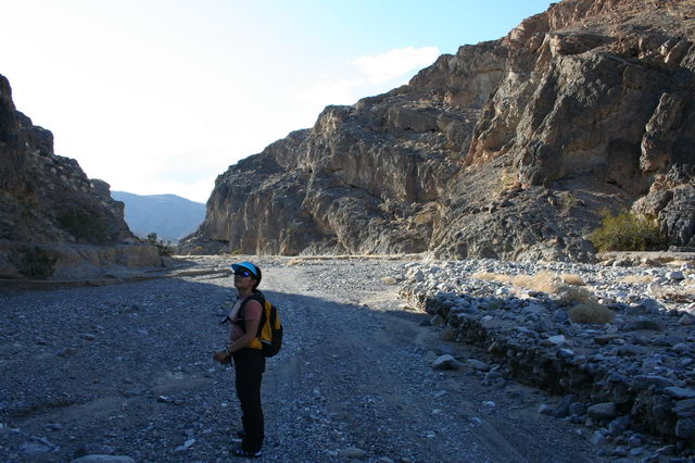
That evening, after having had a frustrating search for petroglyphs and chafing from the yucky-neighbor-hives I proposed that we move our camp a couple of days earlier than we had previously planned.
The next morning, we broke camp early. I was so eager to leave that I proposed that we skip breakfast and just make a hasty departure. That we did, but not before Erik politely paused the van by the yucky-neighbor and said our goodbyes. I myself had desperately preferred the idea of waving, as we drove hurriedly away in the cloud of dust. Good riddence!
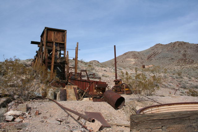
Inyo Mine Ruin
 |
That afternoon we came across the Inyo Mine Ruins. Erik had a lot of fun looking through the old sifters and various rusty pieces of mine machinery. This site was fairly well preserved on account of the fact that it hadn’t been closed for very long, it was last operational in the 1940’s. |
Echo Canyon
After thorough exploring, we decided to head further up the dirt road through Echo Canyon, where we found a nice wide spot to make camp. The next day we decided to take some of the hiking trails to wander further up the Canyon wash.
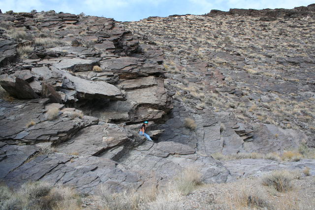
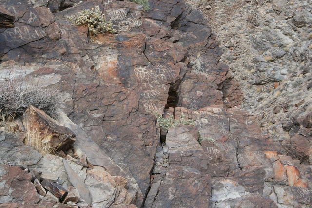
The Art We Found
After several bends in the trail, the canyon swung a sharp turn to the right and on our right was a 30 foot tall rock wall that had many outcroppings of red rock, reminiscent of bookshelf set with books of varying widths, with some faces jutting out more than others. We scrambled part way up the rock, exploring the faces, and started to notice a sprinkling of petroglyphs here and there.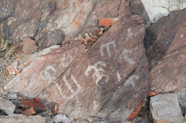
We decided to climb to the top, and discovered that the faces of the walls were quite generously littered with petroglyphs, some of which, due to their weathering were obviously quite old. It was so inspiring to think that we were enjoying works left to us by artists from so very long, long ago. They had, in my mind, achieved a small modicum of artistic immortality.
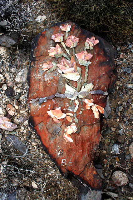
The Art We Left
The top of the rock wall was strewn with thin leaves of colored rocks, sized perfect for picking up. They were starkly different from the rounded, duller rocks and pebbles that characterized the ground cover of the canyon floor. Like chips of brightly colored paint, they called to me, with their swirls of vivid oranges, bright whites, sultry roses and violets. So what else was I to do but squat among all the chips of color and collect, like some hoarding little monkey? Fortunately, I had formulated a plan that involved me leaving my treasures in their native canyon, so our van would not be blessed with the extra weight of my pack-rattishness. (Cool new word!) My avid rock hounding was in a way inspired by the knowledge that I was going to be making a mosaic. And so the result of all my hoarding, and Erik’s patient waiting, and help with gathering a few final straggling pieces was a nice little piece that I like to call “Flowers and Carp and (N36.49714, W116.68121)”. If you happen to be headed out to Death Valley, catch it while you can, it’s probably going to have a limited showing, considering the elements! |
 |
The experience brought to mind something that I heard on an NPR interview, something that really stuck with me. There was a woman who was being interviewed for an education piece, and she said something of Art. “Art,” she said, “Is the opposite of war.” And she went on to describe how it had helped some of her inner-city youths overcome the grim circumstances of their living situation and achieve brighter futures. Art can be transcendent for the artist and help others on their journey as well. And that is one of the really cool things about art.
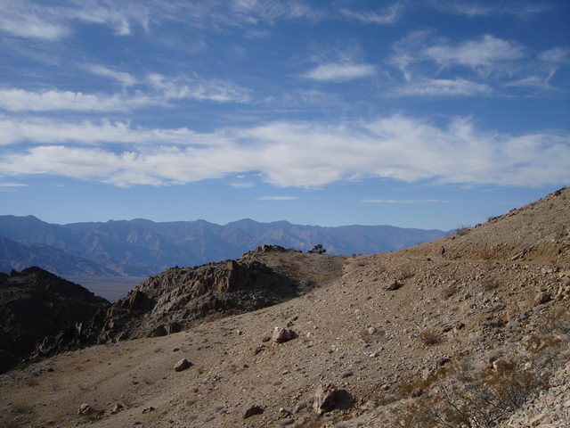
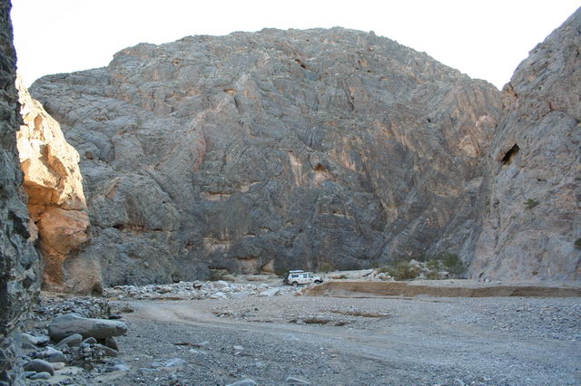
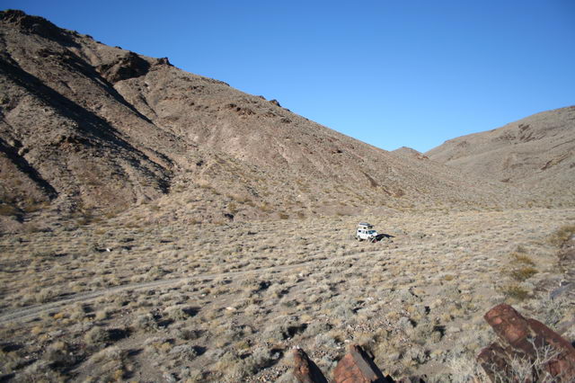
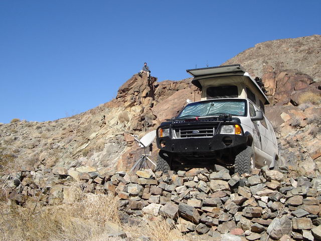
The Funeral Range Trail – Our First Level 6 Trail!
| After several fruitful days in Echo Canyon, it was time to move on again. We were going to head into town to pick up a few supplies, maybe drink in some coffee and atmosphere. Only this time, Erik wanted to take the “trail less traveled”. And that is how I ended up standing at the top of a rock wall waving my arms in the air (AKA spotting) as the wind battered at my back and Erik maneuvered our poor tortured home carefully over a vicious collection of what looked like evil van-eating-ice-chest-sized-boulders-that-were-just-waiting-for-a-slip. At least that was how I saw it, when we climbing the crux of the Funeral Range Trail, which by the way was rated at an Expert Driver Level in the Backcountry Adventures Trail book – a level 6! | 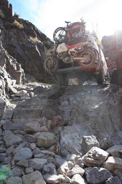 |
 |
Some how, either due to good communication skills or sheer luck and balls (Yes, Erik can now officially claim to have enormous balls of steel!) we made it through both tough points in the trail without a scratch. Kudos to Erik on the driving and path layout, I just guided the van along the path that he sketched out for me. I was just management. |
After an unexciting visit to the unexciting town of Pahrump, NV, which by the way wasn’t town enough even to have a decent standalone latte shop, we left to return back to Death Valley National Park.
Willow Spring
The history of our next camping spot included some failed mining efforts. The mine never even fully opened for business. There were a scant few leftover relics but the spring located there was purported to run quite voluminously. We pulled into camp pretty late that night, and so weren’t able to immediately locate the spring.
It turned out the daylight wasn’t much help either in our quest for the spring. Sure, there were a lot of willowy looking, green leafed trees in the valley below the hiking trail, but they were so dense that they made trekking through their midst near impossible. So we decided to give our spring quest a rest, since we weren’t in a hurry for water. Although we had been thinking, it would be nice to have extra water to do laundry.
| The next morning, we decided to approach our quest again. And we hiked around the grove of trees until Erik found what he thought would be a good spot to try to make a go at it. And I wisely hung back as I listened to the crunching and more crunching as Erik muscled his way in the direction of where he thought the water might be. He came back to report that yes, there was water, but it was rather yucky. The water was flowing around the trees, and where the trees weren’t there was dead vegetation covering the water. We weren’t that desperate for water so we decided to abandon the endeavor for the moment and go on a hike instead. | 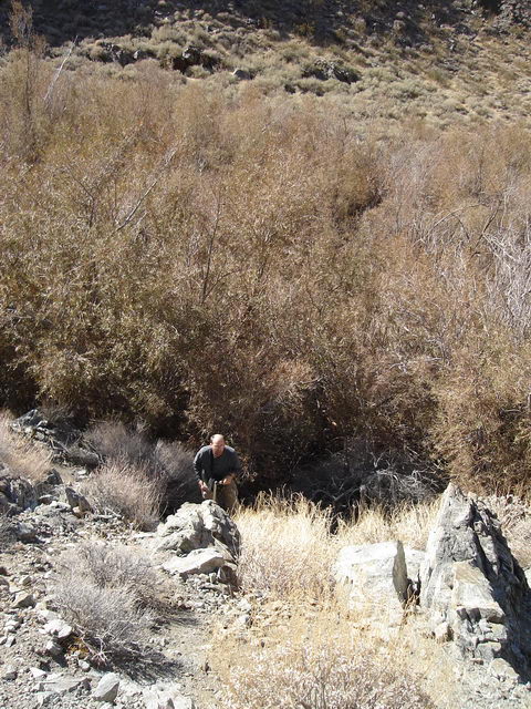 |
 |
And of course, what else would we find further along the hiking trail but access to clear, unobstructed, running water! We marked a wide-spot where we thought we could get the best access with our bucket and decided to return later. |
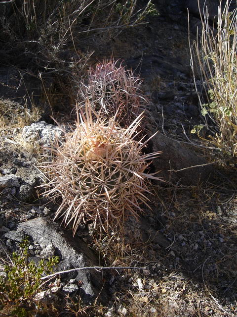
And of course along the path to water, there grew the occasional cactus. And if we hadn’t mentioned them before, there are tons of cacti, especially Barrel Cacti, in Death Valley. And I hated running across them along hiking trails! It’s like you’re peacefully tromping along, minding your own business, and yes, not paying too much attention to where your feet are going and – Smack! They leap out at you from like, nowhere – those nasty little ground urchins… Ah well, I’m just getting worked up, but I always itch for a machete when I see one in my path. Hack, hack, hack! |
 |
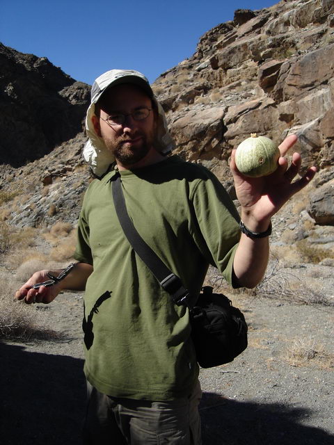 |
We also ran across another horticultural curiosity, one that was a bit less threatening but also common to the Death Valley area – the Coyote Melon. We thought that while we were at it, we might as well collect a few and look up their edibility. As it turned out, only their seeds are really palatable, so we abandoned the idea of eating them, as we were lazy and not at all hard up for food. And instead we used them for their next best purpose – a melon toss contest! |
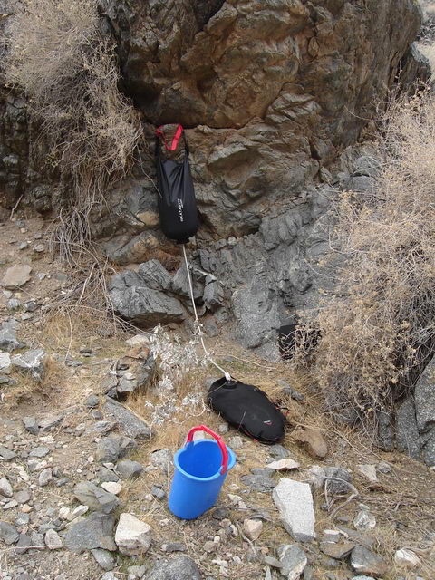
| The next day we made our first filtration foray, we carried down our Katadyne gravity filter, a water bladder, and a bucket. We created a small rock dam in the creek, and after some settling, filled the filter bag with the bucket which then filtered into the bladder. We returned to camp, successful and the water from the filtration was perfect-tasting. |
 |
Later the same day, we took a short hike up the 4x4 trail from the direction that we had driven in, and took in some the views of the valley and surrounding peaks. The next day, we did another water run, but found that our little dam had created an uneven flow pattern resulting in a swirling that was trapping some matter on the water’s surface. So we did some rearranging of the rocks and repeated the filtration process.
Back at camp we got to discussing ways of improving the clarity of our source water, and I suggested that we try lining the bottom of our dipping spot with rocks, like the way the hot spring pools were paved at the Saline Upper Warm Springs that we had visited earlier last week. Our digging had left the bottom of that area exposed with dirt and old vegetation, and even the subtle disturbance of the bucket scooping water raised a fair bit of flotsam. So the next morning we decided to give the pool paving approach a try. And the results were well worth it! The resultant water was the clearest stuff that we had collected by far.
We also finally got around to doing some of our laundry that morning. And I admit that my children-sized underwear is rather colorful, and well, I guess that a passing hummingbird really fancied the colors also. Erik missed getting a picture of the hummingbird, but he swore that little guy stopped in his tracks to look, and settle on a nearby rock to peer for several good moments at my unmentionables before passing. Well, I’ve found that my pink polar-fleece jacket has historically caught the attention of hummingbirds, but this was a first for my underwear.
That evening we went on our farthest and last hike back up the 4x4 trail, breaking from the trail to follow a wash, cross-country and climb part of a peak. The views were lovely, but it was again time to be on our way soon.
Nevada Nowhere North of Las Vegas
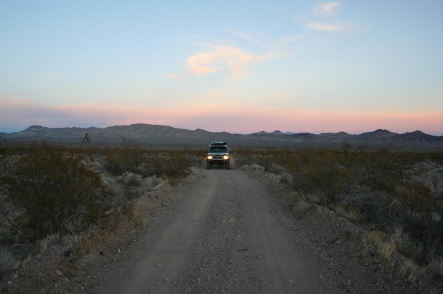
The next day we made a trip into town to Starbucks and it was late by the time we left to find camp for the night. So we got off the freeway at an exit where there looked like there were a lot of trails, at least according to our GPS software. And we drove out a ways past some private property and found a relatively remote spot to boon-dock with nice views
Beaver Dam Mountains and the Paiute Primitive Area
The next day, after a trip into civilization for groceries and cell-phone connectivity, we left the town of Mesquite, NV to go looking for more adventure.
As we headed out towards our planned destination 4x4 trail, we noticed a dirt trail that lead off into the distance towards a gap between some hills. It looked interesting enough, so we made a detour off of the main road and followed the dirt road instead.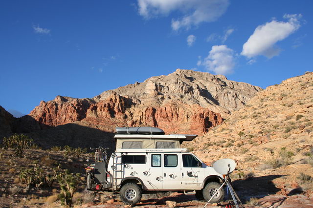
| We ended up finding a charming little slick-rock spot in a canyon surrounded by red rock buttes, and peppered with Joshua trees and Barrel and Chola Cacti (which by the way, Erik can personally attest to being painful when stuck with – silly Erik I told him that all pointy plants should be approached with machetes, not hands! Hack first, ask questions later. If it’s a pointy or spiney plants, I say kill it! Kill it! Yaaay! Same thing goes for spiders – creepy little bastards…). We settled in and made camp for the weekend. | 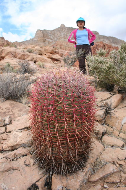 |
 |
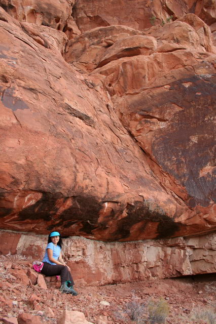
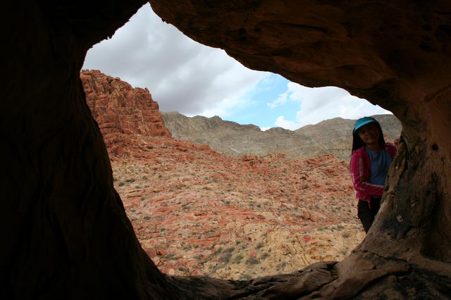
The next afternoon, we scouted the surrounding cliffs and hills of the Beaver Dam Mountains, hurrying in our exploration to stay ahead of the slightly menacing weather that threatened moisture. We climbed up on a ledge a third of the way up an impressive looking butte, and it looked quite scalable, but we decided against finishing the rest of the climb because of the weather that looked to be blowing in. And instead, climbed down and scooted over to look at an interesting cave, which as it turned out didn’t have any current inhabitants, but was still really cool. |
Web Log Sections (Newest at Bottom):
- 06-2005 - Pickup the Van, First impressions, NYC Licensing Show
- 07-2005 - Work on the Van
- 08-2005 - Salt Lake City, Paragliding, & Work on the Van
- 09-2005 - Seattle, WA/OR Coast, to Magruder Corridor, & More Work on the Van
- 10-2005 - Western Montana, Wyoming, to Salt Lake City
- 11-2005 - City of Rocks, Mountain Home, ID, SLC
- 12-2005 - Moab, UT & Canyonlands NP
- 01-2006 to 02-2006 - Snowboarding and Seattle
- 03-2006 - Paris
- 04-2006 - Paris & London
- 05-2006 First Half - Paris
- 05-2006 Second Half - Southern France
- 06-2006 to 07-2006 - Return to the states and Yoga Center
- 08-2006 - Sportsmobile Rally, Colorado
- 09-2006 - End of Yoga, Bamf, Vermont, Boston, St Louis, Badlands
- 10-2006 - Work on Van (wheels, roof, wiring); Amy's version of last couple months
- 10-2006 Second Half - Amy's trip to Las Vegas; Great Basin NP
- 11-2006 - Nevada, Oregon, Motorcycle Race
- 12-2006 - Southern Oregon, California, Christmas, Aluminess Bumpers
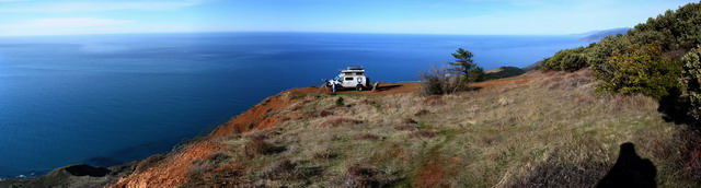
- 01-2007 - Christmas w Shane & Laurie, Camping above Pacific Ocean
- 01-2007 - Pacific Ocean to Death Valley
- 02-2007 - Death Valley to Arizona
- 03-2007 - Zion NP, Grand Staircase NM, Bryce Canyon NP, Canyonlands NP
- 04-2007 - Utah through Arizona, Anasazi Ruins, Some tweaks to the van
- 01-2008 - Holiday trip through Northwest US
- 07-2008 - Spring and Summer 2008 (WiVi arrives!)
- 12-2009 - Camping Trip, Breakdown, and lots of Work on Van.
- Current