www.BadgerTrek.comAbout/ContactWeb LogOur Camper Van
Resources:Hobbies:MotorcyclesAmy's CakesOutboard Hydroplane RacingRadio Controlled Toys |
As always, click the small pictures for bigger versions....
The last entry left us in the Paiute Primitive Area Wilderness in north-western Arizona. The spot we found was beautiful, and just a few hundred feet from the AZ/UT border. A couple days of hiking and exploring the area (as well as piling up all the large trash we found, and taking some of the smaller (it appears to have been a dumping ground for quite some time)) 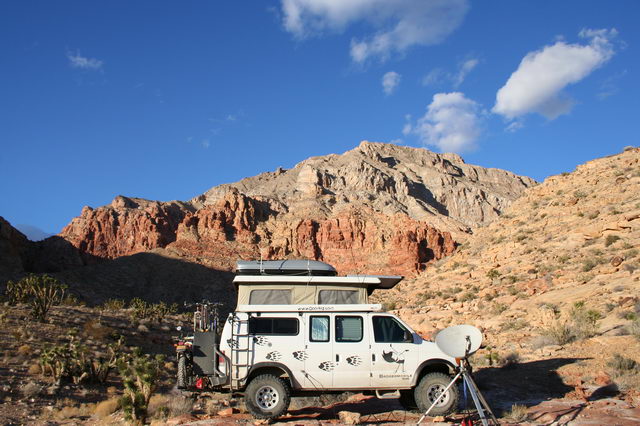
We headed out from the camping spot and continued through the Beaver Dam mountains and into St. George, UT. This was our first time in that area of Utah, and we were quite impressed with the beauty of the whole area.
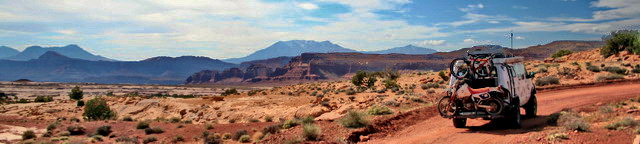
We grabbed a bite to eat in a small cafe in St. George, and then headed east through the small town of Hurricane, and then south along the base of the Hurricane Cliffs. We quickly left civilization and about 10 miles out from the town reached the base of the Honeymoon Trail which climbed the cliffs. We chose to take our night at a short track off the main road, and tackle the trail in the morning. We did end up getting rocked about a bit by the wind that night, and ended up descending and dropping the roof for less noise. I suppose the name of the area should have clued us in.
The next morning we headed up the trail. According to our literature on the area, the trail gained its name from the Mormon pioneers who would trek along this path from their homesteads to get married at the temple in St George, the first completed in the state of Utah.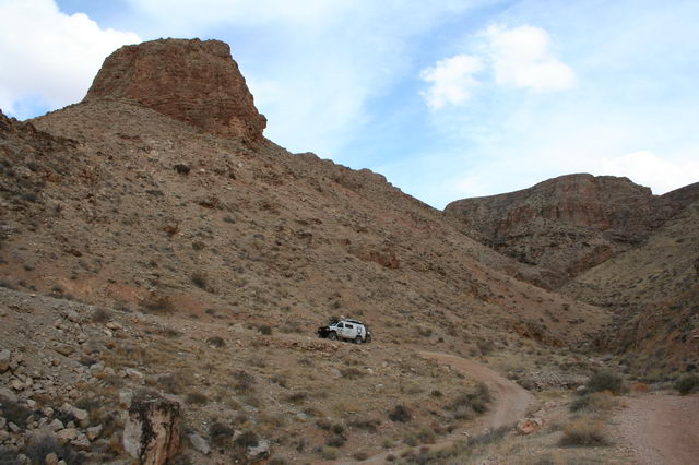
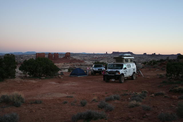
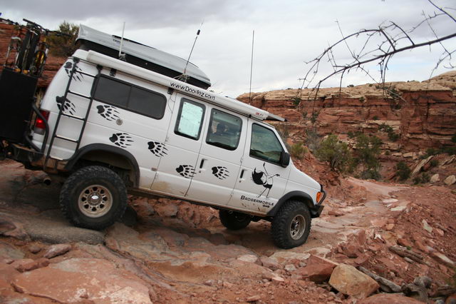
Our trail guide rated the trail as a 6/10, but we found it to be fairly easy, especially compared to the ones we had tackled in Death Valley. There was one small off-camber rocky outcropping to pass, where according to Amy the van was 3-wheeling for a bit, but nothing daunting. Once past the rocks the trail leveled out and we were at the top, just a couple miles later, and only 1/4 mile in a straight line from our camping spot the prior night. The view was magnificent though, with big storm clouds rolling in and shafts of sun-light here and there in the valley below us, so we chose to spend the night at the top and get some air by hiking around before the storms hit us.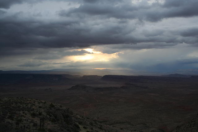
We stayed only one night at the top of the cliff due to another night of strong wind. By mid-morning we were back on the road, choosing this time to tackle a trail just south of Zion national park, with good views of the peaks in Zion, and supposed isolation.
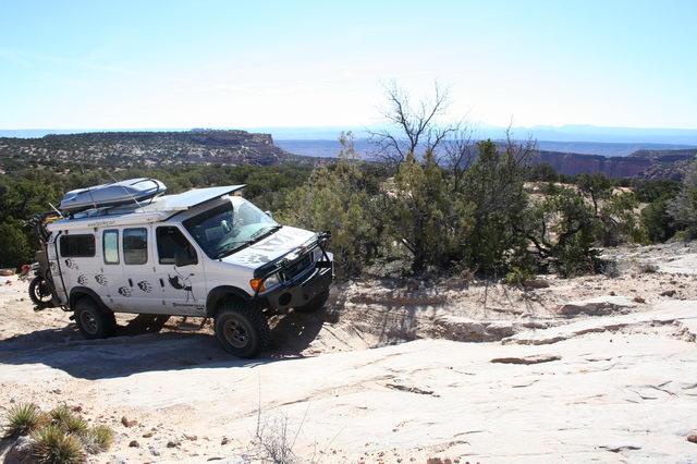
The trail was in an area of sand-dunes and juniper trees. The largest users appeared to be ATVs, leading to a lot of berms in the corners as the trail wound between the trees, complicating the route for us with our relatively excessive length. Luckily we had moved the bicycles down from the roof or we would never have been able to go very far.
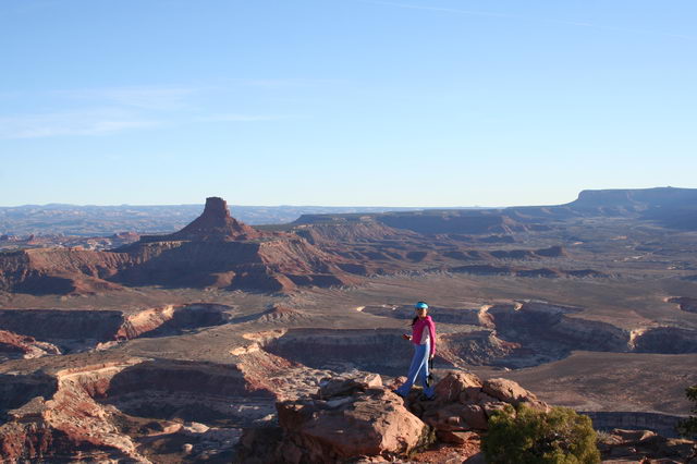
We did not have any trouble with the sand itself, we had aired the tires down to about 20psi, and the snow over the last few days had largely melted, making the sand damp and solid. The views of Zion from the trial were spectacular, though a ways off in the distance. The trail itself descended after some time and finally revealed the end at a point overlooking an alien landscape of red slick rock formations and a river canyon far below.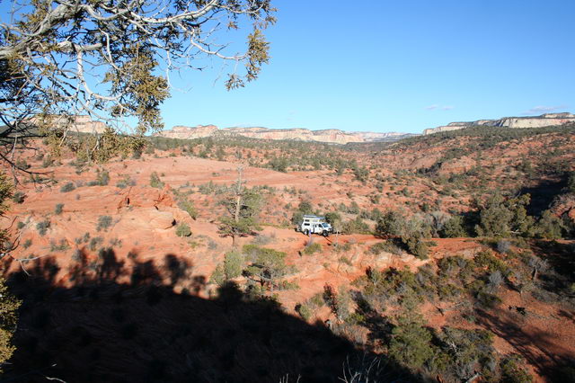
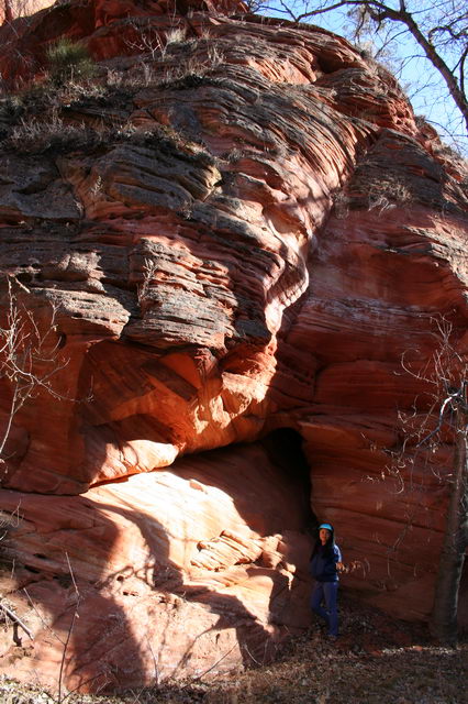
We arrived fairly late, near sunset, so exploration of the area didn't start till the next morning. We poked around the point we were on for a bit, where a large stand of rock at the very end of the promontory provided un-surpassed views of Zion and the area we were in. After a few hours of that we chose to find a way down to the river. Accessing the river proved a bit more difficult than we had anticipated from above. We would periodically find ourselves at a dead-end with just a cliff before us as the way down. Finally, by following the local game trails, we found a route that was manageable, and hit the river about 30 minutes after starting out. The river canyon where we descended was the junction of a small creek coming down one canyon, joining the main river. The area had a flat meadow of trees with the river coming and leaving in narrow slot-like breaks in the rock at each end. Debris, puddles, and bent plants in the meadow indicated that the river had overrun its banks in the recent past. The rock around the meadow had also obviously seen much water erosion in the past, with small arches, caves, and nooks carved everywhere. |
 |
The sun disappeared from view in the bottom of the canyon after a short while and we headed up to escape the cold air that began flowing down into the meadow. The climb up we used to explore a bit up the edge of the smaller canyon, encountering a scoured sandstone wash that we followed all the way up till it intersected the trail we had taken in the van.
Although the trail had been reputedly very remote and private, we found that each day a number of ATVs and a few jeeps would come by our spot. On the third day a group of about 10 ATVs came through and had lunch at the overlook, so we decided to vacate the next morning since that would be Saturday and undoubtedly bring even more visitors.
Since we were so near Zion National Park we swung back that way on Saturday. On the way we took the Smithsonian Butte road heading towards the park, and in my opinion the views from that drive were better than any inside the park itself (at least from the road). We took many a picture as we headed towards Zion down that road.
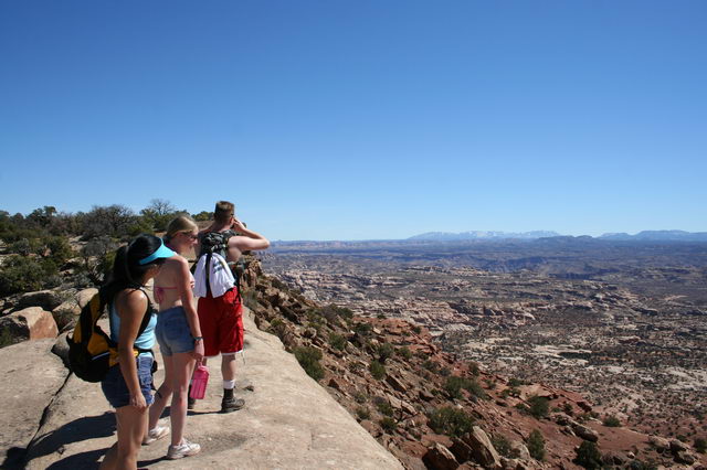
After lunch at one of the restaurants just outside the park we headed in and found the place packed. Our idea of entering on a weekend was proving to be a bit foolish. We did manage to find a parking spot at the end of the main park road, and hiked around a bit, but the attention our van was getting made us a bit antsy leaving it unattended for long. The park itself is quite beautiful however, and well worth the visit. Next time we will need to show up during a weekday, and probably spend our time doing some back-country hiking.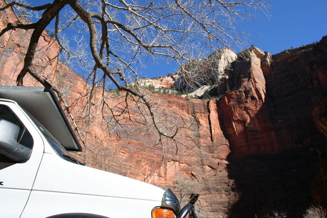
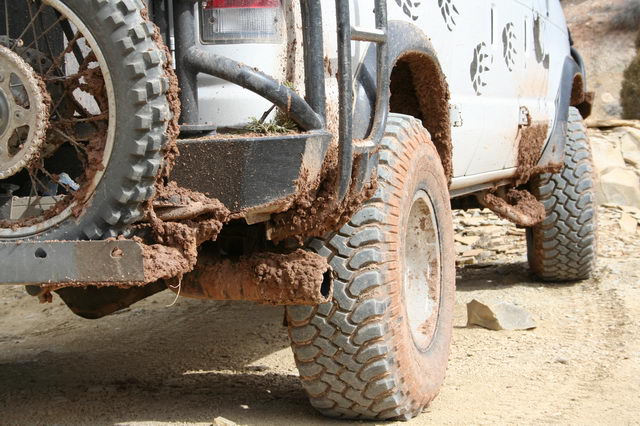
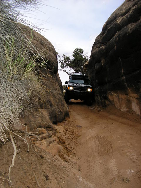
| We left the park heading east, passing through a couple of tunnels bored right through the sandstone peaks of the park, and headed into the Grand Staircase-Escalante National Monument. Our eventual goal was Bryce Canyon National Park, and this provided an alternate route to the highway. Evening was also coming, so we were on the lookout for a side-trail. It revealed itself as a track out to Deer Spring Point. We turned off and very quickly found out that the trail was exceedingly slick mud from the recent rain and snow. The track was also fairly narrow, with junipers on both sides rubbing the van, so turning around was not often possible. Progress was made however once the lockers were turned on, and I learned to straddle the deep ditches the runoff had cut along the track. By the time we hit the end of the trail I had found need to use the lockers, front and rear, the hand-saw we carry for getting rid of tree-falls, the full traction potential of the new mud-terrain tires, and all the clearance the extra few inches of tire yielded. The van was a sticky muddy mess, and the track didn't even lead to a viewpoint. | 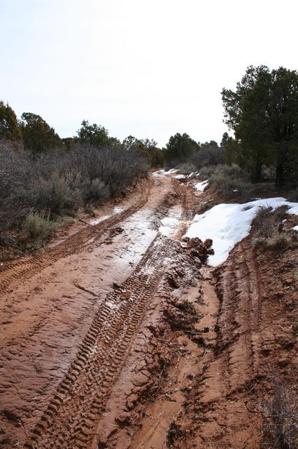 |
We returned to the main road the next morning, after a short hike to the cliff edge where we had a reasonable view, but nothing spectacular with all the clouds around. A few miles along the road we passed into the Kodachrome basin, with the sun sending rays down here and there where the clouds did not interfere.
For lunch we traveled down the road to Grosvennor Arch, a fairly unique double arch in one of the rock formations in the same general area. The weather was not very cooperative, with some sprinkling and less and less sun as the day went on. We soon were in the mood to find another camping spot and hunker down after the stresses of the last few days. A spot down a lightly used dirt track surrounded by junipers was just what we wanted, and we got an early camp setup.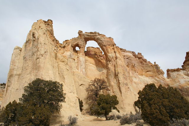
We took an early start the next morning and headed north to hit Salt Lake City by the evening, and beat the forecast snowstorms. This route took us through the north end of Bryce Canyon, and we managed a few views from the state highway of interesting rock formations.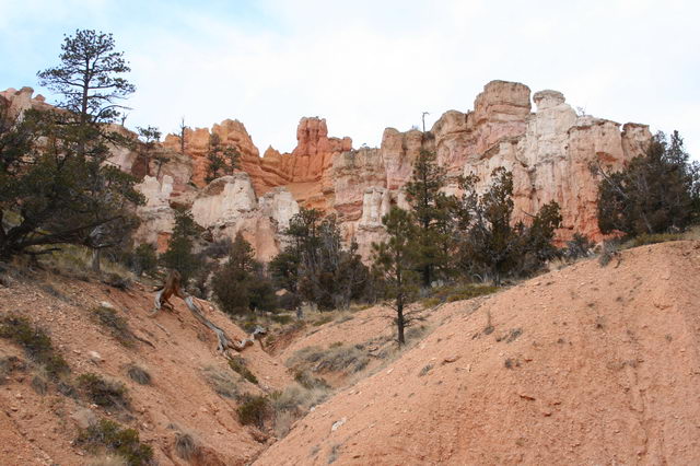
We hit SLC in the evening, and settled into Amy's sister's place for a stay. I packed up for a trip to work in Seattle, while Amy and her sister got to spend a week hanging out.
On my return to SLC we visited with a family we had met last year at the Sportsmobile Rally, and then took the van into a Ford shop to address some recurrent issues we had with noises from the engine and a broken engine mount bolt. This visit turned into even more of a hassle than our last visit to a Ford dealer, and a week later we had the van back with no changes, no improvement, and a fairly firm impression that they did not ever want to see our van again.
We spent the next day re-stocking the pantry, water, and doing our semi-annual cleaning of the van. Then Thursday morning we headed south to meet up with some folk we met online at www.expeditionportal.com that we had scheduled to travel into the remote side of Canyonlands National Park with.
Thursday night we stopped at a reservoir a bit south of Green River, UT. The scenery was stark and stunning with an amazing abundance of water in the reservoir compared to our other visits to this area.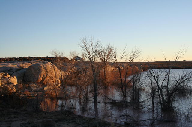
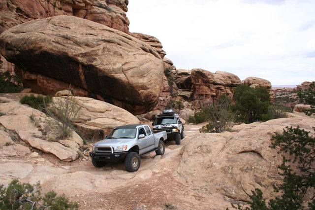
The next morning we traveled down to the Hans Flat ranger station for northern Glen Canyon Recreation Area and the Maze District of Canyonlands NP. We met up with the folks, Sean and Katie, we were traveling into the park with, and confirmed our reservations with the rangers.
For the first night we were scheduled to camp at Panorama Point. The road out was the first 4x4 trail in the park we traveled. With the difficulty of the trail and the remoteness of that section of the park we were the first vehicle tracks in the sand since the last rain, and we only encountered a party of 3 hikers. At the camp-site we were situated on a cliff-side with an awe inspiring view of the entirety of the Canyonlands park and off to the La Sal mountains in the distance.
The next day we headed deeper into the park. About 6 hours of driving took us about 3 miles straight line to the maze overlook camp-site. We did stop in the middle of the drive for a hike down the Golden Staircase trail.
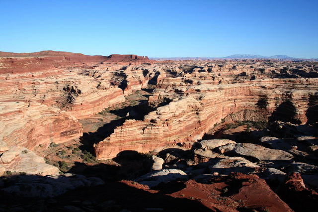
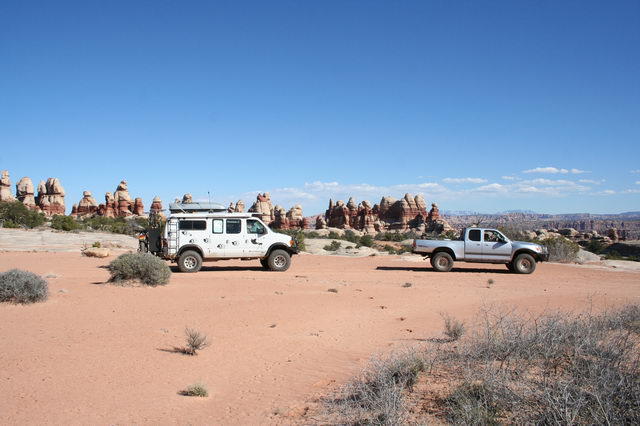
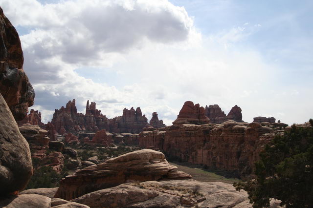
Once at the maze overlook we could see into the labyrinthine canyons of the maze itself. Off in the distance the Land of Standing Rocks and the Doll House area were visible, where we were scheduled to travel the next day.
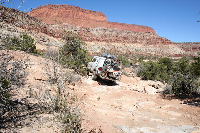
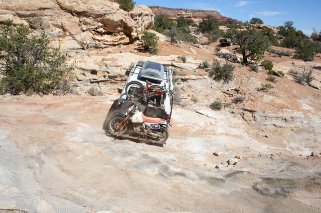
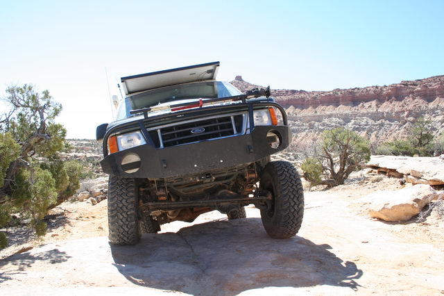
In the morning we headed out early, as the drive into the Doll House was expected to take about 8 hours. First we had to retrace much of the trail we had taken into the Maze Overlook. We then traveled a few miles on fairly smooth roads till we got to the Teapot Rock camp-site. Lunch there was followed by some of the most endurance sapping 4x4 trails we had ever been on. We were, however, impressed by the ease at which the van crawled up and over all of the obstacles. The extra clearance our 37" tires provide was well used considering our motorcycle carrier hanging off the back, which we only scraped a few times, with no significant damage.
We stopped at the end of the harder section at the Land of Standing Rocks for a half-hour of relaxing and cooling off the vehicles while enjoying the scenery. 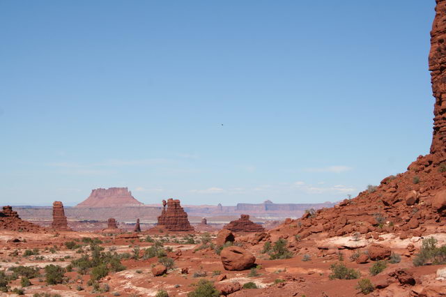
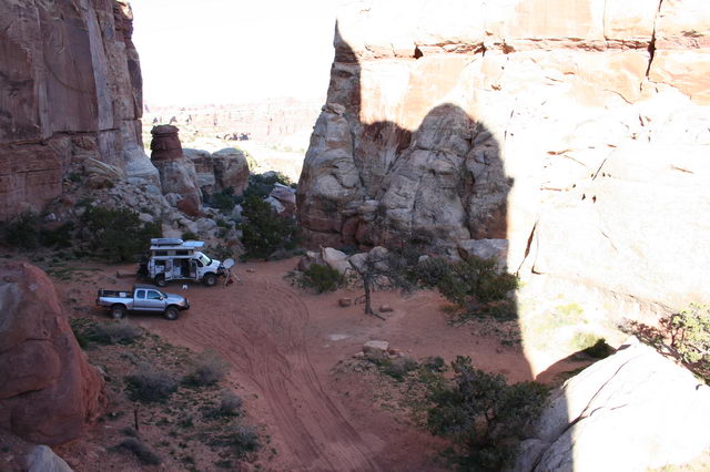
As we got to the Doll House evening was falling, so we setup camp, and had dinner. I was busy with some critical issues at work, so the dish went up as soon as possible. I then secluded myself in the van for the evening and most of the next day.
The next afternoon I broke from work for a breather and the four of us hiked a trail to an old Anasazi granary.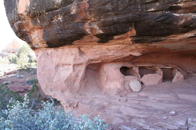
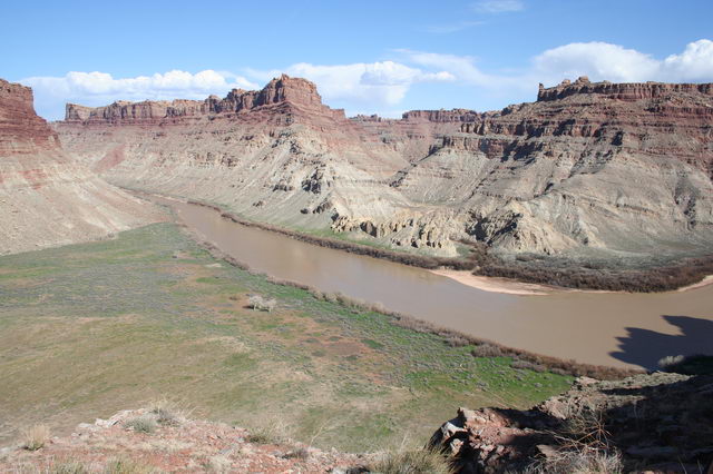
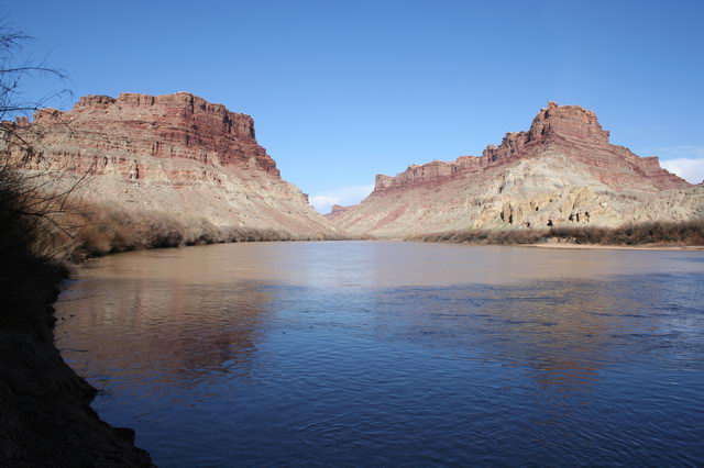
The trail was quite quick, so we decided to continue the trail down to Spanish Bottom where we got to the shore of the Colorado River. The trail was quite an experience descending very steeply over jumbled rocks for over a thousand feet of elevation before ending in a fairly large flat meadow at a bend in the river.
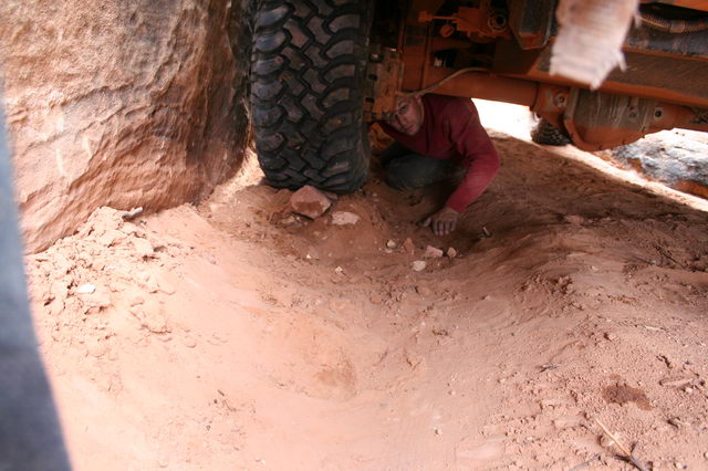
Continuing our whirl-wind tour of the area the next day saw us heading back out the rough trail to teapot rock, and then all the way out south to the highway. From there we drove to Monteciello, UT for fuel, groceries, and dinner. We did loose about an hour of travel time when the driver-side front hub blew out and stopped engaging. A panicked 1/2 hour of disassmbly showed that the star that loads the spring to engage the hub had slipped a thread and was not holding the lock-ring in place. Nothing was significantly damaged, and we were rolling again after an impromptu lunch.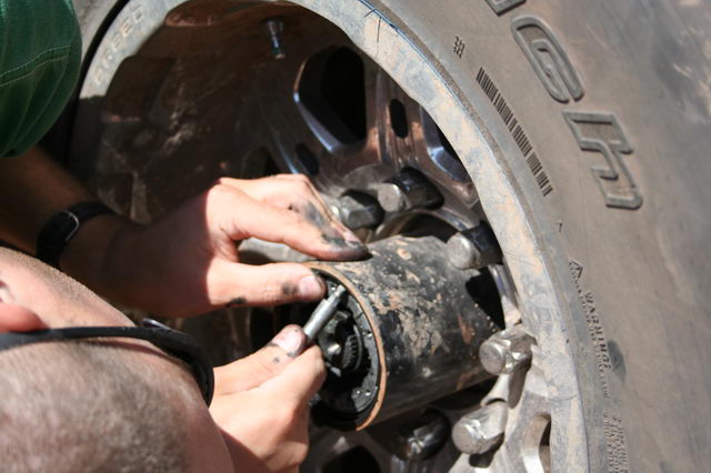
Our goal was to enter the Needles district the next morning, travel over the Elephant Hill trail into the Devil's Kitchen campground for a three night stay. To accomplish this we spent the night at a primitive BLM campsite just outside the park boundary, and drove into the park in the mid-morning.
At the Elephant Hill trail head we aired-down our tires, and followed Sean and Katie up the hill. The trail was actually easier to travel than we had anticipated given the 7/10 rating in our trail book (3.5/5 on the common scale used around Moab). The hills were steep, and having to back down one of the switch-backs was unique to our experience, but in low 4 the van just crawled up and down over everything without much complaint.
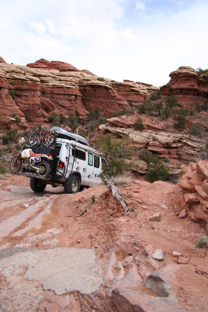
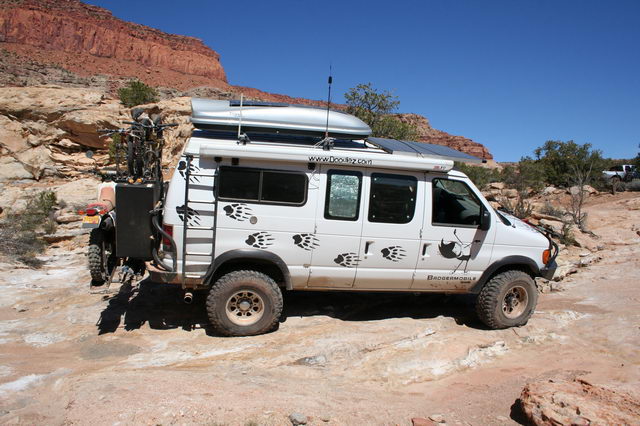
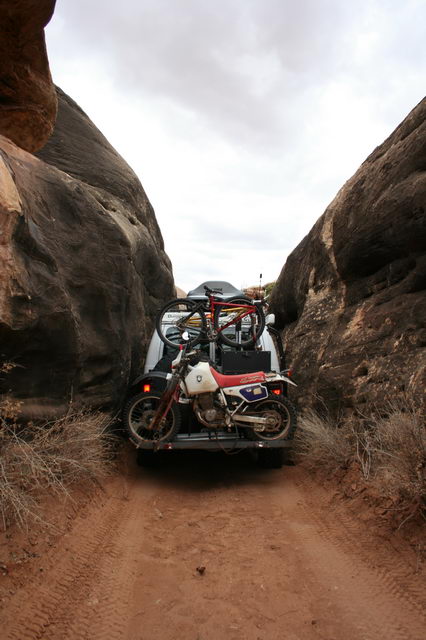
The one difficult part we had was the "squeezeplay" where the trail travels through a very narrow rock slot. Sean's Tundra passed through without much trouble, so we headed in, but found that with the extra height of the van the driver's side mirror and bumpers were just at the height of some bumps sticking out from the side of the slot. To get through we ended up removing the mirror and stacking rocks and dirt to tilt the van towards the passenger side to clear the rock walls. At the end we ended up with only a couple minor scratches in the powder-coat of the bumpers which was completely hidden when touched up with some satin black paint I cary for such occurrences.
After the tension of the squeeze, we setup camp in Devil's Kitchen. Just outside of our camp was an awesome view of the Needles of Chesler Park.
Amy, Sean, and Katie did a few hikes in the days we spent at Devil's Kitchen, while I got the pleasure of sitting at the computer all day for work. 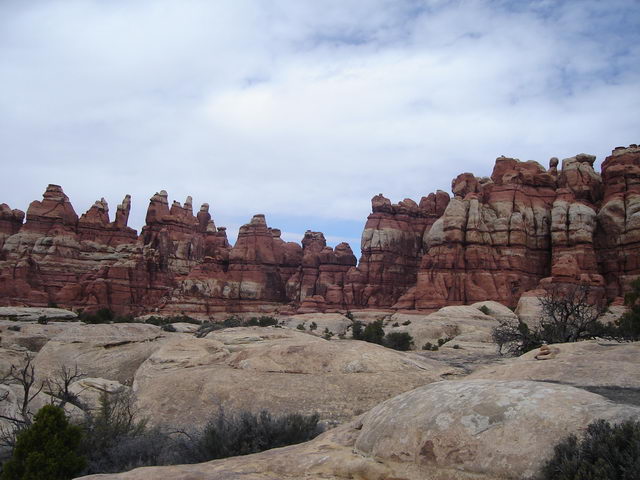
On the third day of our stay we got the unexpected pleasure of experiencing a thunder-storm in the desert. The other three had driven out to do a hike, with clouds looming over-head. A couple hours later the booming started, and light rain started falling. Just as the hail hit they returned early from the hike and we hid out in the van while a torrent fell from the sky. The rocks all around sprouted water-falls, and parts of our camp-site turned to miniature ponds.
After the rain ceased and the sun returned we explored the area and found parts of the road to be washed partially out, pools of quick-sand, and just an amazing array of changes to just the local landscape.
Saturday morning we arose, packed, and headed back around the Silver Stairs trail towards Elephant Hill. Along the way headed to the Colorado/Green river confluence overlook trail, took a few photos in the drizzle, and then continued the Silver Stairs and on to a retracing of our path over Elephant Hill.
We aired up the tires, filled water at the park campground, and then went into Moab for lunch. After lunch we parted ways from Sean and Katie as they headed back to Denver, and we went in search of a camping spot to relax.
Web Log Sections (Newest at Bottom):
- 06-2005 - Pickup the Van, First impressions, NYC Licensing Show
- 07-2005 - Work on the Van
- 08-2005 - Salt Lake City, Paragliding, & Work on the Van
- 09-2005 - Seattle, WA/OR Coast, to Magruder Corridor, & More Work on the Van
- 10-2005 - Western Montana, Wyoming, to Salt Lake City
- 11-2005 - City of Rocks, Mountain Home, ID, SLC
- 12-2005 - Moab, UT & Canyonlands NP
- 01-2006 to 02-2006 - Snowboarding and Seattle
- 03-2006 - Paris
- 04-2006 - Paris & London
- 05-2006 First Half - Paris
- 05-2006 Second Half - Southern France
- 06-2006 to 07-2006 - Return to the states and Yoga Center
- 08-2006 - Sportsmobile Rally, Colorado
- 09-2006 - End of Yoga, Bamf, Vermont, Boston, St Louis, Badlands
- 10-2006 - Work on Van (wheels, roof, wiring); Amy's version of last couple months
- 10-2006 Second Half - Amy's trip to Las Vegas; Great Basin NP
- 11-2006 - Nevada, Oregon, Motorcycle Race
- 12-2006 - Southern Oregon, California, Christmas, Aluminess Bumpers
- 01-2007 - Christmas w Shane & Laurie, Camping above Pacific Ocean
- 01-2007 - Pacific Ocean to Death Valley
- 02-2007 - Death Valley to Arizona
- 03-2007 - Zion NP, Grand Staircase NM, Bryce Canyon NP, Canyonlands NP
- 04-2007 - Utah through Arizona, Anasazi Ruins, Some tweaks to the van
- 01-2008 - Holiday trip through Northwest US
- 07-2008 - Spring and Summer 2008 (WiVi arrives!)
- 12-2009 - Camping Trip, Breakdown, and lots of Work on Van.
- Current