www.BadgerTrek.comAbout/ContactWeb LogOur Camper Van
Resources:Hobbies:MotorcyclesAmy's CakesOutboard Hydroplane RacingRadio Controlled Toys |
2007-05-24 (E)
At the end of the last log, near the end of April we were camped above Tucson, AZ in the Coronado National Forest. Well, actually, I was camped there while Amy spent the weekend with a friend at a Spa just outside of Tucson.
At the end of the weekend we met up in town, and began our trek North-East. We were scheduled to meet up with my parents in Grants, NM mid-week, and we had only a few days to get there. This would require a more rapid pace than we we have grown accustom, so we stocked up on groceries, fuel, and water before leaving Tucson and looked for the most interesting semi-direct route.
We settled on the old US highway 666 through the eastern mountains of AZ. From the map and a few folks recommendations it looked like it went the right direction, and had plenty of twistyness and elevation change to offer a bit of variety over the freeway.
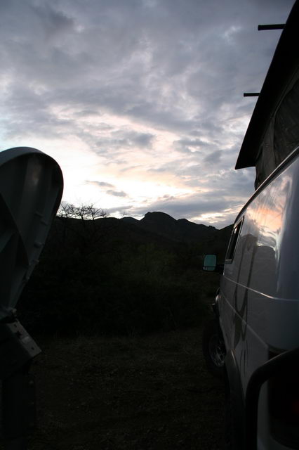 |
The first night we camped at the beginning of the highway, a few miles from where it broke off of I10. We found a nice dirt track leading up into the forest which soon turned to a wash with some trees and patches of prickly-pear cactus around. The weather was still blustery from a cold-front that had passed through over the weekend, so a few showers came and went as we setup camp, but the sunset was quite pretty. |
The next day we headed up to Clifton, a rather charming town dwarfed by the huge copper mine just up the valley from the town center. The highway winds up the canyon wall next to, and then through, the old mine tailings. The mine was full of activity, and we drove by a spot where a construction crane (which I am use to seeing in the city for building large buildings) being used to assemble a huge dump-truck from its constituent parts.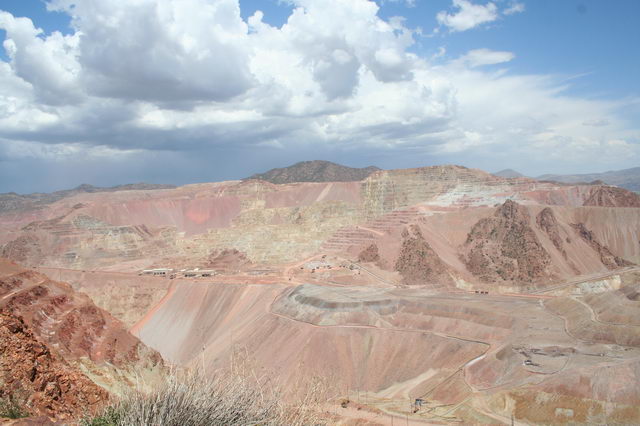
Past the mine the road began to climb quickly into the National Forest, and became quite twisty. The next near 100 miles were a motorcyclist's dream. Nice smooth pavement, nearly no traffic, twisty road at nice high elevation for cooler weather, and awesome vistas off the sides of the road. The elevation climbed to about 9000' before beginning the descent to Alpine, AZ.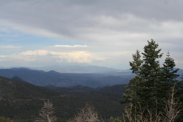
We went a few miles further, and found a field outside of Springerville, AZ, near the New Mexico border, to spend the night, with cell reception so that we could verify the next day's meet up with my parents. The storms were still making their presence felt with passing showers and the odd rain-bow visible.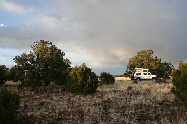
Rising early the next morning we headed into New Mexico and towards Grants. The route we chose wound through the El Malpais National Monument, an area with old sandstone cliffs and arches rimming a valley filled with relatively recent lava flows. We stopped for a break at the La Ventana Arch just a few miles outside of Grants before heading into town to wait at the Airport for my parents.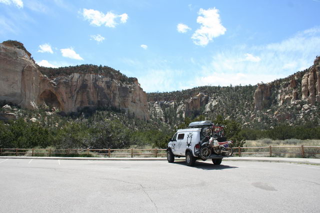
The weather was quite blustery still, and after a few hours at the airport my parents called to say they had made it to Canyonlands airport outside Moab, UT, but were not sure they could get all the way to Grants given the weather. We headed up Zuni Canyon to find a track that would lead to the hill above the airport so that we could still have phone coverage if my parents did make it into the airport, but in the likely event they wouldn't we would have a camping spot.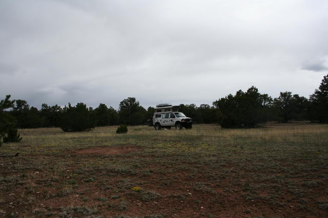
An hour after we setup camp we found that my parents had stopped in Farmington NM for the night, about 100 miles from Grants. We scheduled to meet them at 9 the next morning and relaxed for the evening in a nice field of flowers among the Junipers. A few thunder-storms passed overhead in the evening, but by morning the sky had cleared substantially.
Around 9, back at the airport, we heard the plane come in and greeted my parents. They had flown in in my fathers latest passion, a fairly new Super Decathalon.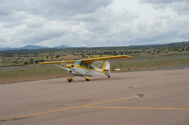
After tying the plane down, we headed into town, grabbed some lunch, and began the search for a parcel of land owned by my parents that they had purchased in the time before I existed. After a bit of hunting on some rocky roads that looked not to have been used in many years, we found the area, and spent the afternoon trimming fallen trees, branches, and moving some large rocks to get the van into the land. We setup our tent for my parents (first use), and spent a few hours hiking around looking for the lot's corner markers.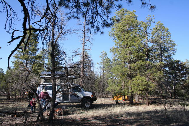
The next day was Thursday, and in the interests of showing how we usually lived (lazily), we simply stayed put with the camp, and just hiked around the area enjoying the sun and forest.
| Friday morning we struck camp, headed back to the airport, and saw my parents off on their way back to Baker City, OR. |  |
We now had a week and a half till we were due in Salt Lake City for some appointments so, choosing a somewhat indirect route, we traveled north to Farmington, NM for the night. After a couple stops to re-fuel, re-food, and re-water in Farmington we found a scenic sand-stone bluff to spend the night just a few miles in the direction of the CO border and Durango.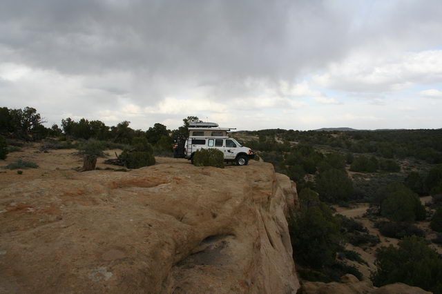
Saturday morning, the 5th of May (hello 32), we visited Durango. It looked a bit touristy, and with all parking requiring meter feeding and the weather dumping rain/snow, we decided to keep going. In the natural manner of Badgers, we went UP to escape the rain, and got to drive through a lovely snow blizzard on the way to Dolores, CO.
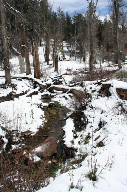 |
Just north of Dolores we pulled off the forest-service highway we were on and took a snowy and muddy road into a meadow with a scenic creek and blanket of snow. We stayed here for the next day as well, hiking around as the snow melted, and watching the various local birds yank seeds out of old dandy-lion tufts that were exposed as the snow melted.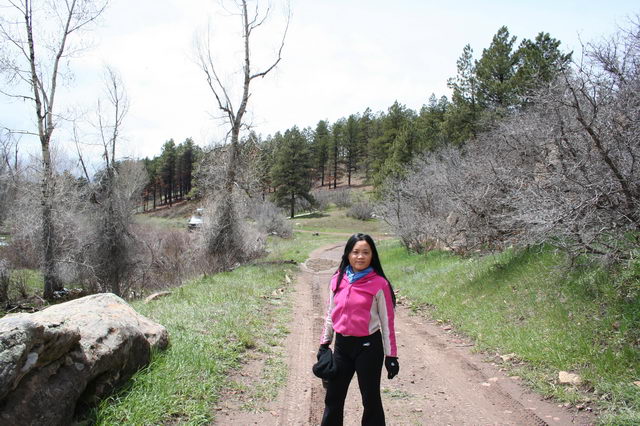 |
Then on again. We traveled north on the forest service road, heading up in elevation again till we entered a very scenic valley containing Blemear lake. As we traveled out of the valley up the flank of Lone Cone mountain, we could see the mountains, the valley, and in a crack between the hills to the west, the canyonlands around Moab and Monteciello, UT.
On the way down from Lone Cone we were startled by a small group of elk deciding to jump across the road right in front of the van. Luckily they weren't too close, and we were not traveling all that fast as we gawked at the scenery. Lunch was taken at nearby Miramonte Reservoir, with a view of Lone Cone peak coming and going as the clouds passed by.
After lunch we headed north again, and were treated to two young, but nearly full-sized, golden eagles taking off next to the van, one of which chose to just glide in ground-effect along the road in front of us for nearly 1/4 mile before flapping a couple times to perch on a fence-post up a hill. Being a bit slow on the up-take, and so fascinated just watching, we just managed a photo as he left the road. 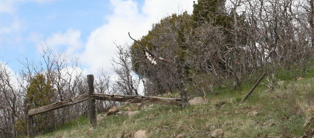
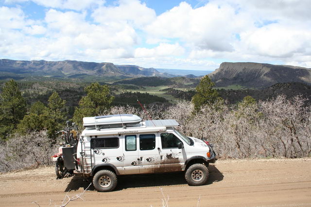
Our route dropped us down into the red-rock canyon lands near Naturita, CO where we began to follow CO 141 toward Grand Junction. Part of the way along we stopped for a break at an old coke-oven (or something similar) by the side of the road, and then decided to look for a camping spot as we had been driving for much of the day.
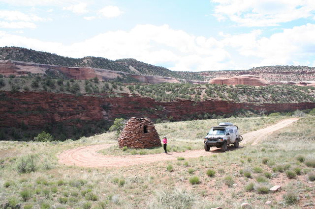
We found a bridge across the Dolores river a couple miles down-stream, and then, using our map, wound our way to the Radium Trail 4x4 track. A mile or two up the track we settled in a small clearing among the juniper, cacti, and our own private red-rock canyon.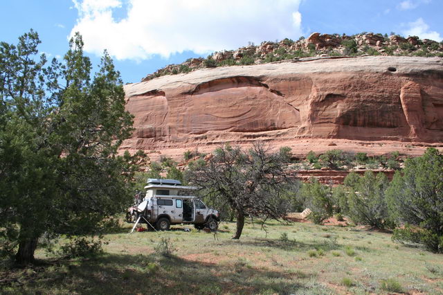
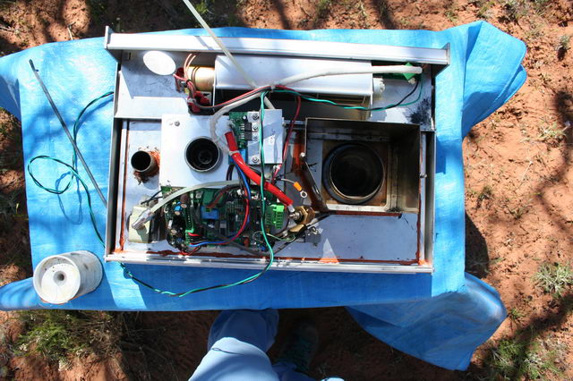
The scenery and rather long drive, prompted us to hang out for a couple days at this spot. Using the down-time we looked into some problems we had been having with the cooktop making squealing noises when running. I disassembled the combustion air fan, lubricated it, and reassembled. We also took the opportunity to clean out the last 2 years carbon soot buildup in the stove with the air-compressor, and seal a few additional gaps in the silicone that were accessible with the fan removed. After this work the stove was again quiet, put out noticeably more heat sooner, and stopped expelling visible smoke from the exhaust pipe. Our reasoning is that the carbon deposits and noisy fan motor were impeding proper combustion air-flow.
We hiked around the next day, exploring a number of old washed out jeep tracks that likely had been put in place in the uranium mining boom the area saw many decades ago. In one place we even encountered a recent rock-fall that had taken out a piece of shelf-road within the last few months based on the still semi-living trees crushed under the car-sized rocks.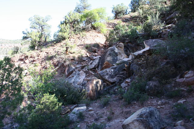
After having enough of this canyon we continued on to Grand Junction, CO and stopped in at the old downtown to look around. We have passed through quite often but never stopped for anything other than fuel, and figured we ought to see what the town itself is like since we like the area. We had lunch at a bagel shop, did some errands at the bank, re-fueled, and then headed north again.
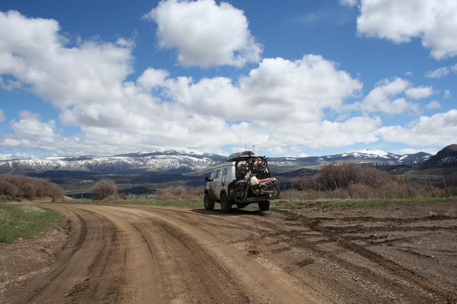
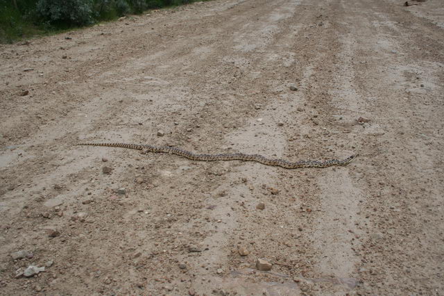
We still had 5 days to get to SLC, so this time we took the Baxter Pass road north. This is a graded dirt road that travels nearly along the CO/UT border north from the Grand Junction area to Vernal, UT. The road was passable, though someone with very skinny tires and a lot of spinning of those tires had obviously taken the road a few weeks prior when it was wet as there were 6-8" deep ruts weaving all over the roadway as the road climbed the hills. We nearly hit one of the locals sunning himself on the road, but luckily he fit between the tires and seemed un-alarmed at his near-miss.
Once at the peak we took a side track, another side-track, plowed through a few remaining snow-drifts, and eventually found ourselves in a meadow right on the ridge-line. The camping spot offered no real view, but we figured we could get one with a hike, and the meadow was very lush and secluded.
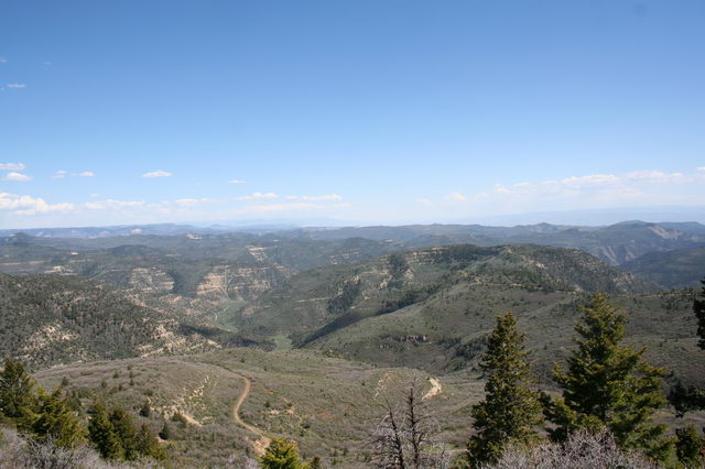
We hiked around the next day and found a nice view south where we could see Grand Mesa, Grand Junction, the La Sal mountains, and all the land in between. We also ran across a small herd of Elk who seemed a bit surprised to see people up there this early in the year.
We stayed in the meadow a few days, enjoying the sun, hiking around, playing with the Aerobie, and flying the kite my parents had given me the week prior for my birthday (Thanks Mom & Dad!). We did see some signs of bears in our hikes, but were not lucky enough to see any in person.
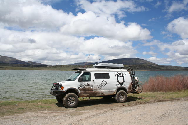
Heading down from the hill brought us by the scenic area around McAndrews Lake, nice and full from the winter runoff.
The road continued to descend, gradually becoming more used by the local petroleum exploration industry in the Rangley, CO area. Eventually we crossed the border into UT, hit the paved highway, and headed into Vernal.
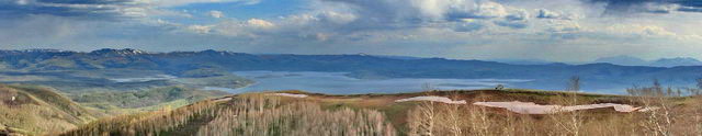
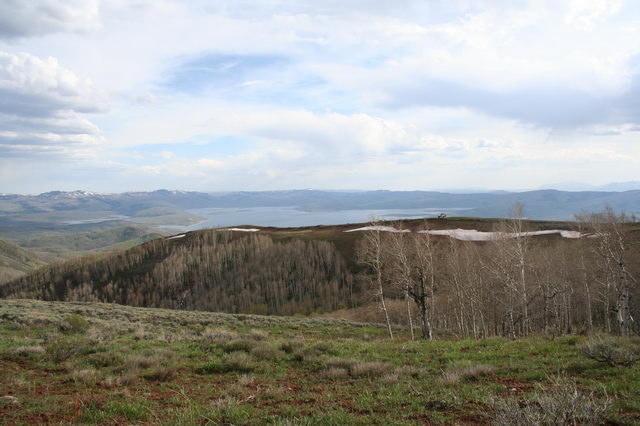
Lunch in Vernal was followed by a couple more hours of driving till we began passing Strawberry Reservoir. The area was close enough to SLC that we would be able to get into town in a couple hours, and remote enough that we could probably find a secluded camping spot. Again, following the law of the Badgers, we headed up, and found ourselves on the end of a ridge at about 9500' a couple thousand feet above the reservoir, with a view of the water, the east side of the Wasatch mountains, and stands of wind-blown trees here and there. Since we had needed to use excessive momentum (yay!!) to get the van through a few snow-drifts on the road, we figured we would have some solitude, and the view was un-matched.
Web Log Sections (Newest at Bottom):
- 06-2005 - Pickup the Van, First impressions, NYC Licensing Show
- 07-2005 - Work on the Van
- 08-2005 - Salt Lake City, Paragliding, & Work on the Van
- 09-2005 - Seattle, WA/OR Coast, to Magruder Corridor, & More Work on the Van
- 10-2005 - Western Montana, Wyoming, to Salt Lake City
- 11-2005 - City of Rocks, Mountain Home, ID, SLC
- 12-2005 - Moab, UT & Canyonlands NP
- 01-2006 to 02-2006 - Snowboarding and Seattle
- 03-2006 - Paris
- 04-2006 - Paris & London
- 05-2006 First Half - Paris
- 05-2006 Second Half - Southern France
- 06-2006 to 07-2006 - Return to the states and Yoga Center
- 08-2006 - Sportsmobile Rally, Colorado
- 09-2006 - End of Yoga, Bamf, Vermont, Boston, St Louis, Badlands
- 10-2006 - Work on Van (wheels, roof, wiring); Amy's version of last couple months
- 10-2006 Second Half - Amy's trip to Las Vegas; Great Basin NP
- 11-2006 - Nevada, Oregon, Motorcycle Race
- 12-2006 - Southern Oregon, California, Christmas, Aluminess Bumpers
- 01-2007 - Christmas w Shane & Laurie, Camping above Pacific Ocean
- 01-2007 - Pacific Ocean to Death Valley
- 02-2007 - Death Valley to Arizona
- 03-2007 - Zion NP, Grand Staircase NM, Bryce Canyon NP, Canyonlands NP
- 04-2007 - Utah through Arizona, Anasazi Ruins, Some tweaks to the van
- 01-2008 - Holiday trip through Northwest US
- 07-2008 - Spring and Summer 2008 (WiVi arrives!)
- 12-2009 - Camping Trip, Breakdown, and lots of Work on Van.
- Current